
Updates
on everything Geocodio
New: UK Census geographies now available
Geocodio can now add Output Areas, LSOAs, MSOAs, Data Zones, local authorities, and more to UK addresses, with official GSS codes for England, Scotland, Wales, and Northern Ireland.
Add UK Census Geographies to Your Addresses with Geocodio
Most UK statistics are published by area, down to groups of a few streets. Census results, population estimates, and deprivation indices all come out as tables keyed to small statistical areas like Output Areas and LSOAs. To use any of that data with your own list of addresses, you first need to know which area each address sits in.
Until now, that usually meant geocoding your addresses, downloading a postcode lookup file, and matching them yourself. Geocodio can now handle that step for you.
Add the uk-census append to any UK geocoding API request or spreadsheet job. Each address comes back with its Output Area, LSOA (Lower layer Super Output Area), MSOA (Middle layer Super Output Area), local authority, and several other official geographies. It covers England, Scotland, Wales, and Northern Ireland.
What the UK Census Data Append Returns
One address, every level. Geocodio returns the Output Area it sits in (the smallest unit of the census), the LSOA and MSOA that contain it, and the local authority above those. Each area comes with its official GSS code, its name where one exists, its type, the vintage of the boundaries, and the agency that publishes them.
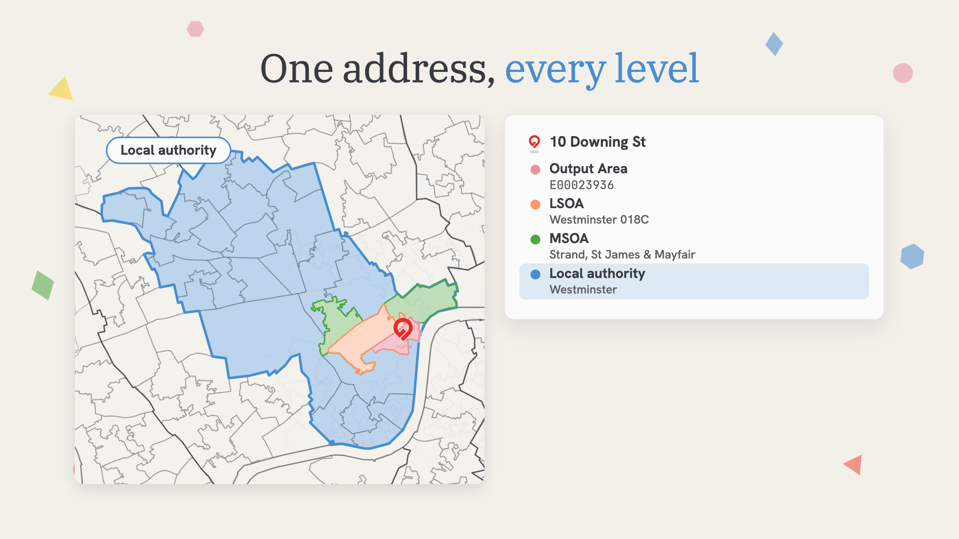
Geocodio also returns four more layers that are useful for regional analysis and reporting. Here is the complete list:
| Geography | API field | Example (10 Downing St) |
|---|---|---|
| Output Area | output_area | E00023936 |
| LSOA / Data Zone | lsoa_data_zone | Westminster 018C (E01004736) |
| MSOA / Intermediate Zone | msoa_intermediate_zone | Westminster 018, "Strand, St James & Mayfair" (E02000977) |
| Local Authority District | local_authority_district | Westminster, London Borough (E09000033) |
| Built-Up Area | built_up_area | City of Westminster (E63004916) |
| Travel to Work Area | travel_to_work_area | London (E30000234) |
| International Territorial Level (ITL 1, 2, and 3) | international_territorial_level | London (TLI) › Inner London - West (TLI3) › Westminster and City of London (TLI35) |
| Rural-Urban Classification | rural_urban_classification | Urban: Nearer to a major town or city (UN1) |
For MSOAs in England and Wales, Geocodio also returns an alternative_name. These are the neighborhood-style names, like "Strand, St James & Mayfair," so an area is much easier to recognize than by its official name, "Westminster 018."
For definitions of each geography, or layer, see the complete UK Census Geographies guide.
How UK Census Geographies Differ in Scotland and Northern Ireland
Each nation runs its own census, and each publishes its own statistical units. England and Wales use Output Areas, LSOAs, and MSOAs from the Office for National Statistics. Scotland uses Output Areas, Data Zones, and Intermediate Zones from National Records of Scotland. Northern Ireland uses Data Zones and Super Data Zones from the Northern Ireland Statistics and Research Agency.
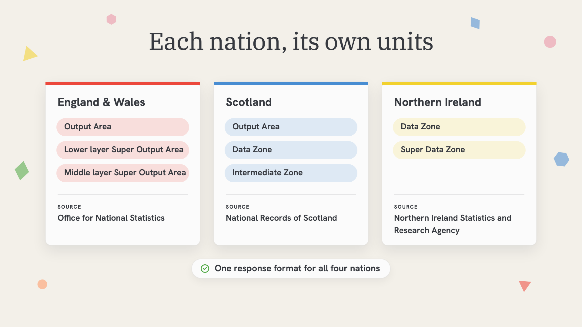
Geocodio returns all four nations in one response format, so you don't need separate code for Edinburgh and Belfast, for example. The field names cover both naming systems, and you will get a type value that tells you which unit it is and a source value that tells you which agency published it.
Join Your Addresses to UK Census Tables with GSS Codes
The GSS code is the part that makes this data useful. GSS codes are the nine-character identifiers the UK's statistics agencies use for every official area, like E01004736 for LSOA Westminster 018C. The first letter tells you the nation (E, W, S, or N), and the next two digits tell you the type of area.
Nearly every UK statistics table is keyed by these codes. Once your addresses have them, you can join your data to census tables, the English Indices of Deprivation, mid-year population estimates, or any other dataset published by area.
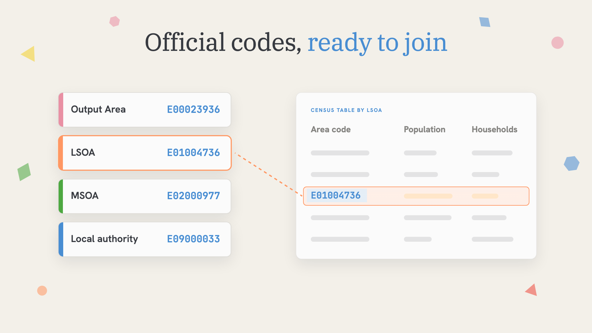
Depending on the questions you're trying to answer, here are a few ways you can use addresses with GSS codes:
Research and public health: Link patient or survey records to deprivation scores and census demographics, then report results by area.
Retail and site selection: Profile the neighborhoods around current and prospective locations.
Charities and public services: See which local authorities and communities your services reach, and where the gaps are.
Reporting: Roll address-level data up to MSOAs, local authorities, or ITL (international territorial level) regions for maps and dashboards.
How accurate is Geocodio's UK Census data append?
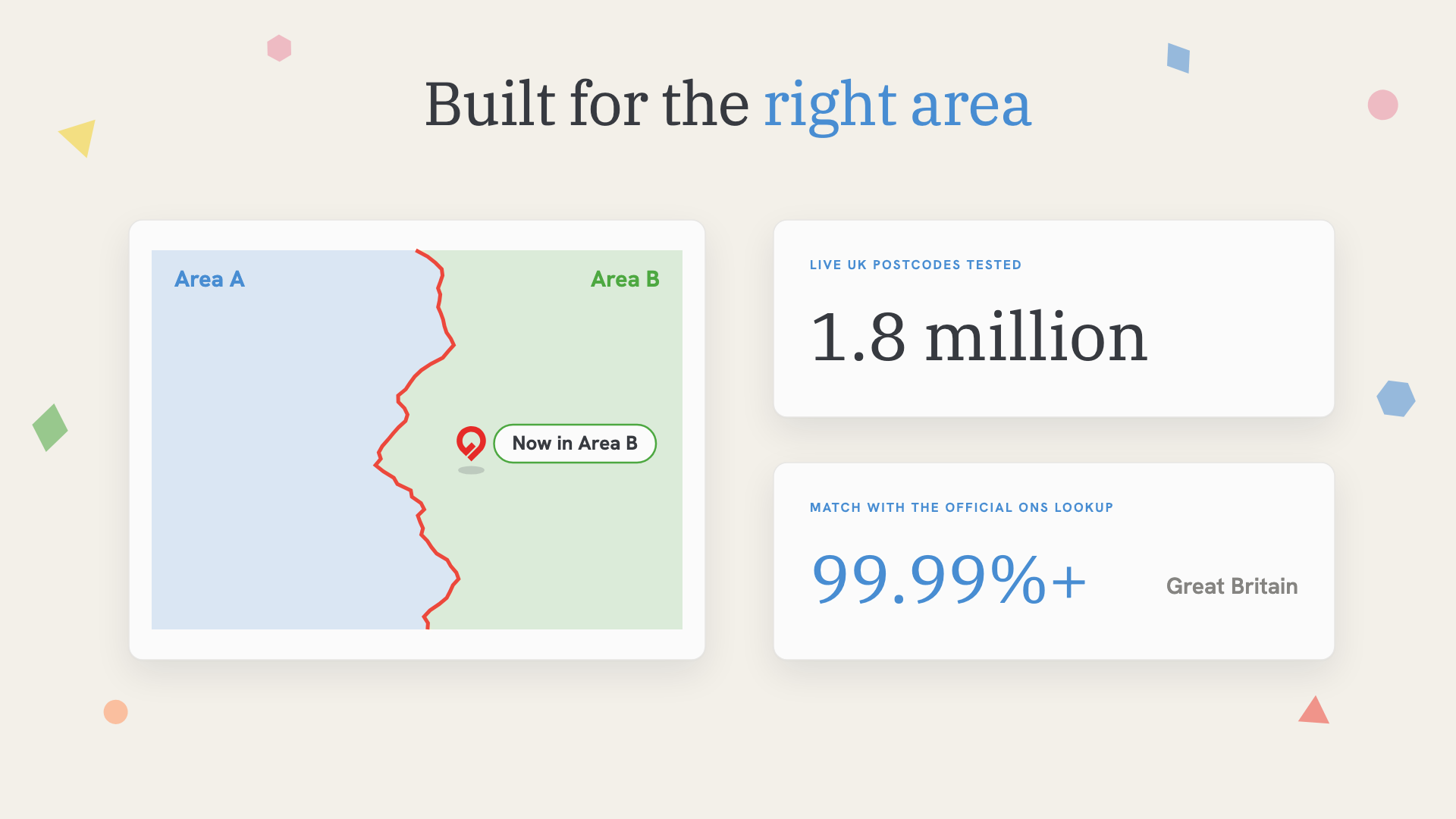
Geocodio's results match the official ONS lookup for more than 99.99% of postcodes in Great Britain. Before release, the Geocodio team tested all 1.8 million live UK postcodes against the official ONS postcode lookup.
How to Get UK Census Geographies
Which plans include the UK Census append?
UK geocoding and the UK Census append are available on any plan with UK access, including our Self-Serve Flex plans and UK-enabled Unlimited plans, as well as on Enterprise. See all plans here.
Request the UK Census data append via API
Add uk-census to the fields parameter on any UK geocoding or reverse geocoding request.
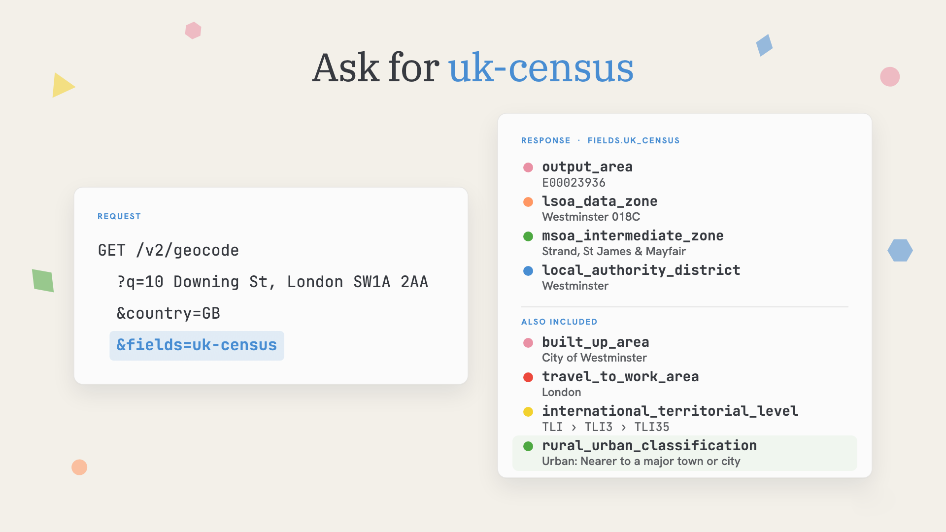
Your API request might look like this:
https://api.geocod.io/v2/geocode?q=10+Downing+St%2C+London+SW1A+2AA&country=GB&fields=uk-census&api_key=YOUR_API_KEYThe results appear under fields.uk_census in the response. For example, here's the LSOA response for 10 Downing St:
"lsoa_data_zone": {
    "name": "Westminster 018C",
    "gss_code": "E01004736",
    "type": "Lower layer Super Output Area",
    "vintage": "2021",
    "source": "Office for National Statistics"
}
You can request uk-census alongside other UK data appends in the same call. See the UK Census API docs for the full response.
Add UK Census geographies to a spreadsheet
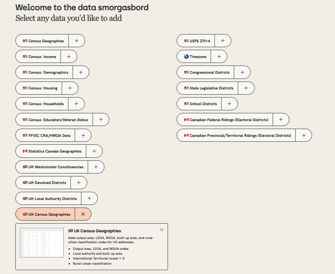
Prefer working with spreadsheets? With Geocodio, you can geocode a spreadsheet of UK addresses and just check the box for "UK Census Geographies" in the Data Appends step. Your file will come back with columns for each geography listed in the table above (What the UK Census Data Append Returns), including each area's name, GSS code, and type.
What does the UK Census data append cost?
Like Geocodio's other data appends, uk-census counts as one additional lookup per address. UK geocoding is available on plans with UK access.
Need help with the UK census append?
You'll always get human support from Geocodio. If you have questions about UK Census geographies, GSS codes, or anything else about data appends, write us at [email protected].
Related
Don't miss what's new
Geocodio ships new features and data updates regularly. We'll only email you with the good stuff, nothing else.
Thanks for subscribing! Check your inbox to confirm.