
Updates
on everything Geocodio
New API v1.10 Release: Census ACS 2024 Data
We've just released Geocodio API v1.10, featuring the latest 5-year Census ACS data (2024) and updated Census boundary geographies. Get the latest insights from your enriched location data with fresh demographic, economic, and social statistics. Read on for more details on this release.
Quick summary: Give Geocodio an address or coordinate pair, and we'll now return the latest Census American Community Survey (ACS) data with average household income, demographics, and more.
What's New in Census data in v1.10?
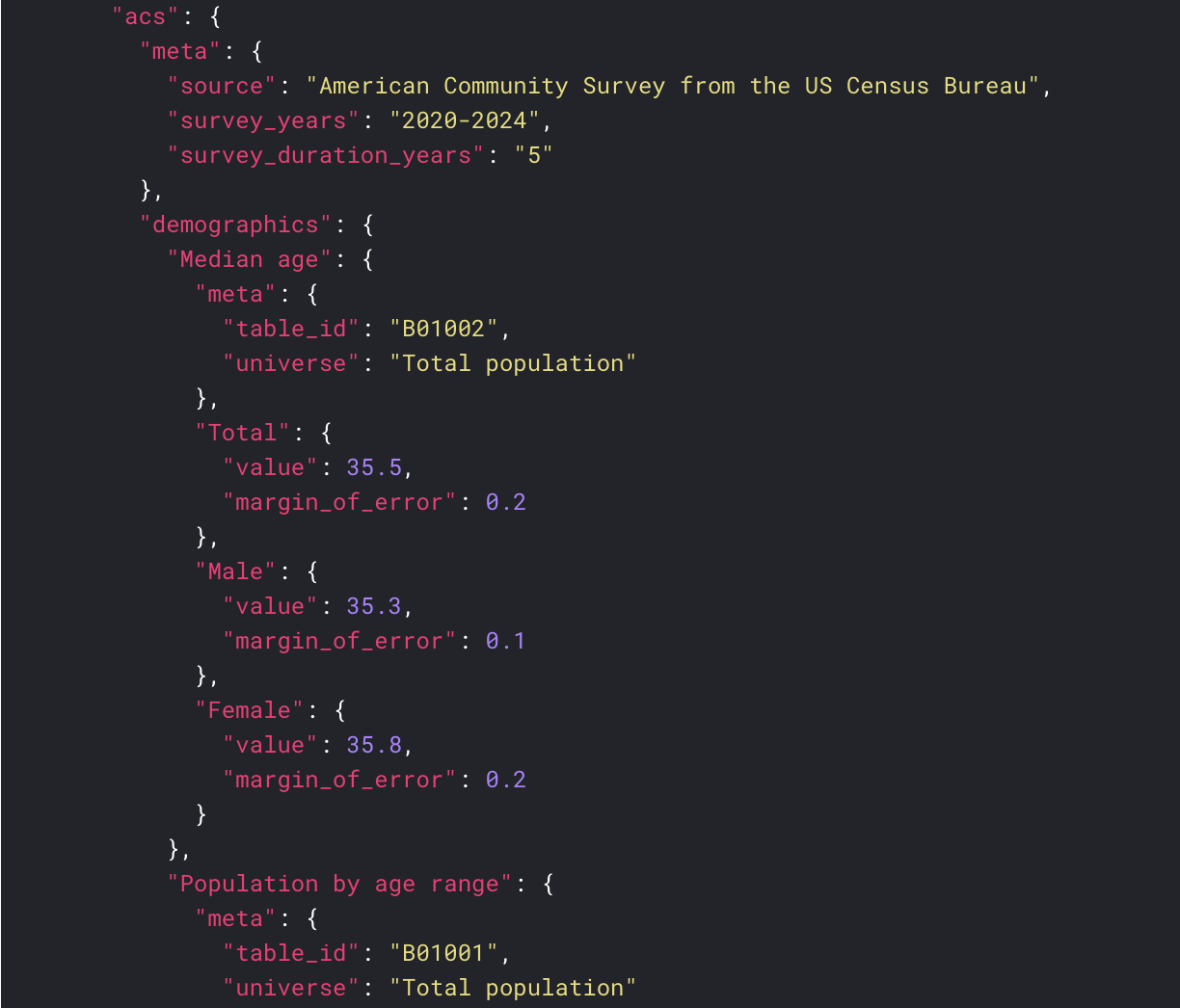
2024 Census ACS Data Now Available
We've updated all of our Census ACS appends to use the most recent five-year American Community Survey data (2020-2024), replacing the previous 2019-2023 release. You now have access to the most current demographic, economic, family, housing, and social statistics available from the US Census Bureau.
Updated Census Boundaries
With this release, we've also bumped the corresponding Census boundary year from 2023 to 2024. ACS lookups are now matched against 2024 boundaries, and the census2024 data append is included at no additional cost with any acs- field lookup (previously census2023).
Also, as of December, Geocodio’s Census data append now returns the most recent geographies (FIPS Codes) released in 2025. If you request the census2025 data append and don't specify a year, it will now default to 2025 Census geographies.
A Note About Table Changes
The Census Bureau occasionally updates table labels between ACS releases, and this year is one of those times. In the 2024 release, Table B21002 has been renamed from "Vietnam Era" to "Vietnam War." This change affects the acs-social field append.
Because this label change could break existing integrations that rely on specific field names, we've released the 2024 ACS data under a new API version (v1.10) to maintain backwards compatibility.
API Version Compatibility
If you're not ready to adopt the latest ACS data or need time to adjust for the table change, previous API versions will continue returning the data you're used to:
v1.10+: Returns ACS 2024 data (
survey_years: "2020-2024")v1.8–v1.9: Returns ACS 2023 data (
survey_years: "2019-2023")v1.4–v1.7: Returns ACS 2021 data
This means you can upgrade on your own timeline without any disruption to your existing workflows.
Working with Census ACS Data
As a reminder, Geocodio organizes ACS results into 5 categories:
Demographics — Population data by age, race, and gender [Docs]
Each category append counts as an additional lookup for billing purposes. As always, basic Census geography data (including FIPS codes) is included at no extra cost with any acs- field lookup.
You can also request ACS data at different geographic levels by appending the geography name to your field request, for example, acs-demographics-tract for Census Tract level or acs-economics-county for County level.
Working with spreadhseets? It's easy!
You can upload a spreadsheet of addresses and one-click add Census ACS data. Just upload your file and check the box for any of the five ACS categories you need in the data appends step. You'll see an option to specify the Census geography from the dropdown menu. If you don't select an option from the dropdown, it will automatically select the most appropriate Census geography level based on the accuracy of the geocoded result.
Getting Started with v1.10
API v1.10 is now live for all Geocodio users. If you're working with Census ACS data, please note that this is a breaking change: 2024 data will now be returned instead of 2023 data.
To start using the latest ACS 2024 data, simply update your API base URL to:
https://api.geocod.io/v1.10/If you're geocoding spreadsheets through the Geocodio dashboard, ACS data appends will automatically use the latest 2024 data.
We're excited to bring you the freshest Census ACS data and hope you find it useful for your projects. If you have any questions or need help with the update, our support team is always here. Reach out anytime.
Happy geocoding!
The Geocodio Team
Don't miss what's new
Geocodio ships new features and data updates regularly. We'll only email you with the good stuff, nothing else.
Thanks for subscribing! Check your inbox to confirm.