
Updates
on everything Geocodio
Census Geography Selection Now Available for ACS Appends in Spreadsheet Uploader
Choose your preferred geographic granularity when retrieving American Community Survey data from Geocodio
Today, we're excited to announce a significant enhancement to the American Community Survey (ACS) data appends in our spreadsheet uploader: Geography level selection for ACS data.
In the past, all of our ACS appends returned only at the Census Block Group level. This new update provides you with the ability to select from a variety of additional geographic options and applies to all of our existing ACS data appends, including:
ACS Demographics
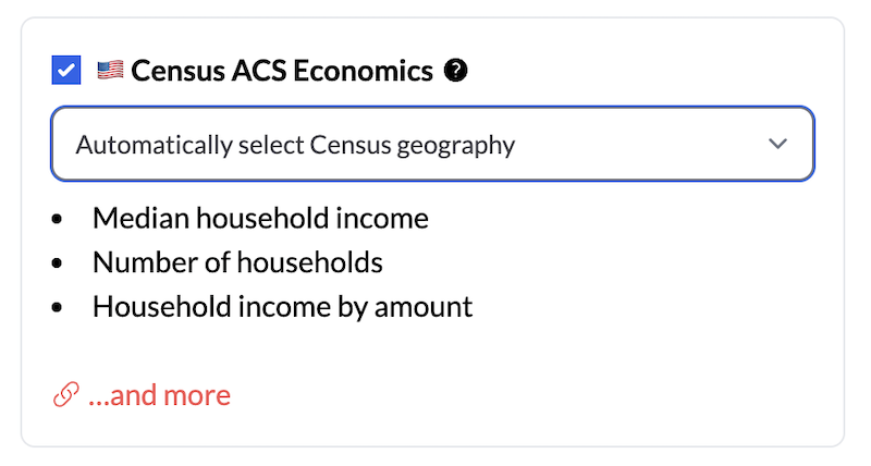
ACS Economics
ACS Social: Education and Veteran Status
ACS Families
ACS Housing
Choose Your Geography Level
With Geocodio, you now have more flexibility when working with Census-based data, allowing you to customize the scope of your response to meet your specific requirements. You can be as broad or granular as you prefer, choosing from the following geographic options:
Census Block Group
Census Tract
Census Place
County Subdivision
County
MSA
State
To specify which geography level to utilize in your ACS response, follow these instructions:
Upload your spreadsheet with address or coordinate data using our spreadsheet uploader.
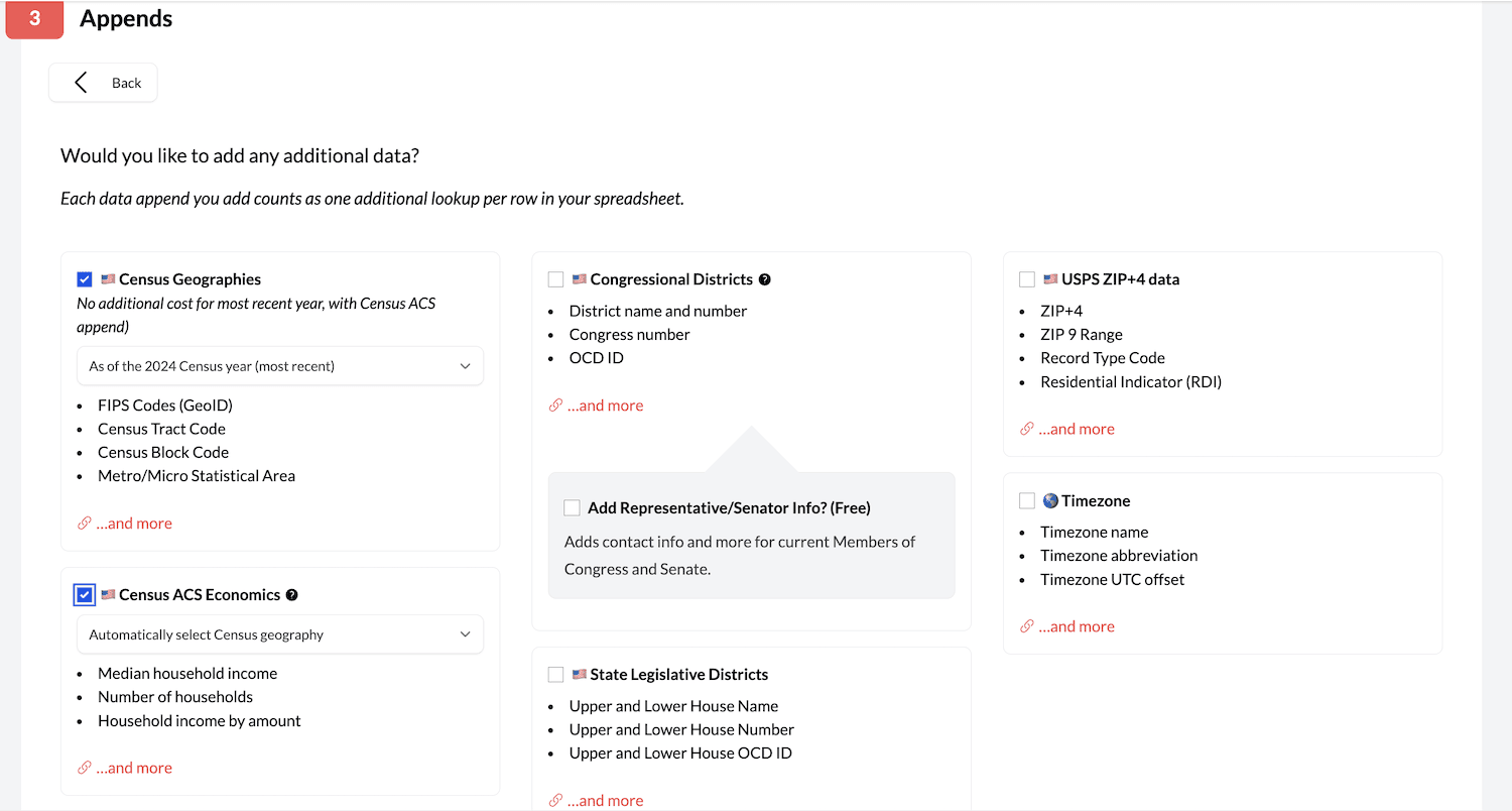
Proceed through the upload process until you arrive at section three: Appends.
Choose which of our Census ACS datasets you would like to append. They are located in the left-most column of the Appends section.
When you check the box to add a Census ACS dataset, a dropdown box will appear. If you click on it, you'll see all of the available geographic options for that dataset. Select the option that makes the most sense and proceed to complete the upload process.
Note: By default, if you do not explicitly choose otherwise, we will return your data at the most appropriate geography level based on the accuracy of your geocoded result. For example:
| Accuracy Type | Census Geography |
|---|---|
| rooftop, range_interpolation, nearest_street, point, nearest_rooftop_match, street_center, intersection | Census Block Group |
| nearest_place, place | Census Place |
| county | County |
| state | State |
What's New in the Spreadsheet Upload?
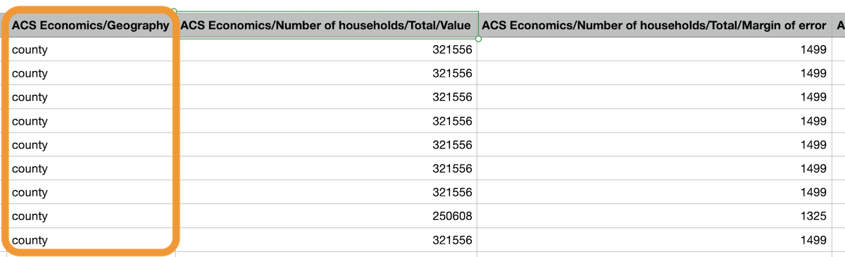
Once you've processed your spreadsheet, the data will be automatically appended at the geography level you've chosen.
You'll receive a new column called "ACS / Geography" which will define which geography level each row in your spreadsheet returned. The other appended columns will remain the same, but the values will adjust based on the geography level requested.
Accessing These Changes
These improvements are available now to all Geocodio users. For more information, please check out our detailed guides.
If you have any questions or suggestions about this new feature, please reach out to our support team.
Don't miss what's new
Geocodio ships new features and data updates regularly. We'll only email you with the good stuff, nothing else.
Thanks for subscribing! Check your inbox to confirm.