Getting Started
What you can do with GeocodioSpreadsheet formattingAddress completionSpelling CorrectionFile sizesFile formatsIntersectionsPreviewing your spreadsheetReverse geocodingData Appends
Data Enrichment OverviewCensus Block/Tract/FIPS/GeoIDUSPS ZIP+4 (Full ZIP9)Congressional Districts & Contact InfoState Legislative DistrictsCensus: DemographicsCensus: Education & Veteran StatusCensus: FamiliesCensus: HousingCensus: IncomeFFIEC DataOCD IDsSchool DistrictsProvincial/Territorial RidingsFederal RidingsCanadian Census GeographiesTimezonesTroubleshooting
Country supportMissing coordinatesMap preview shows AfricaRow estimate too highSYLK ErrorTestingWhy are latitudes/longitudes slightly different when reverse geocoding?What happened to counties in Connecticut?What is a Census Block Group?Missing Leading Zeroes In SpreadsheetCongressional District 00 or 98Billing & Payment
Sales TaxesW-9Pay-As-You-Go CreditsEstimates/QuotesSet a usage limitWhat's a 'lookup'?When will I be charged?Census Block/Tract/FIPS/GeoID
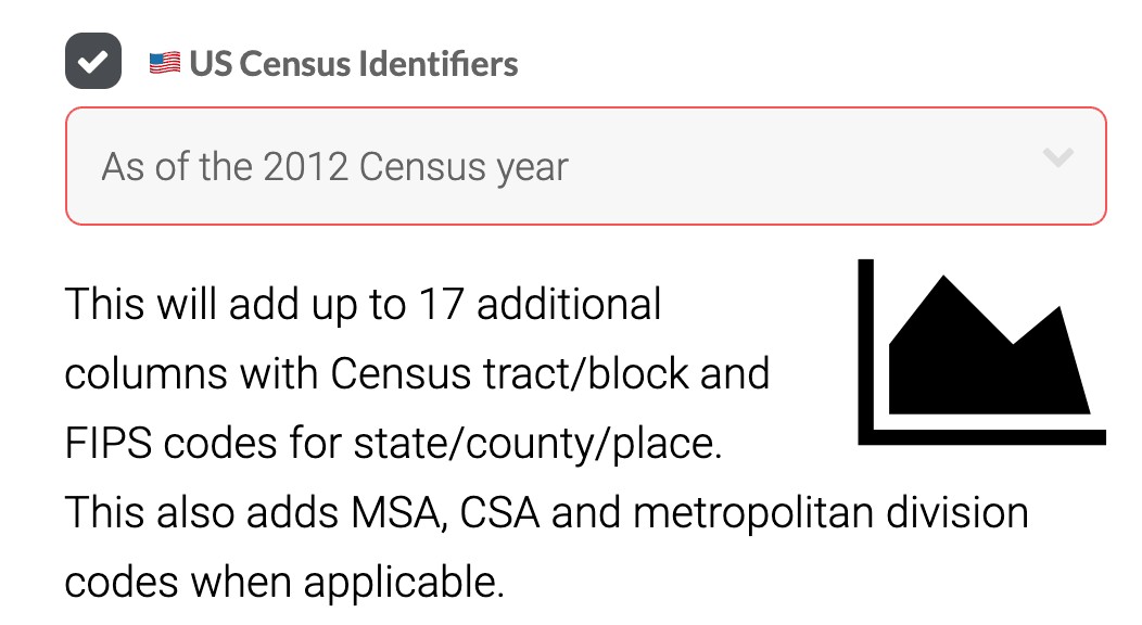
You can upload a spreadsheet of addresses or coordinates to Geocodio to bulk lookup Census geographies such as Census blocks, tracts, and FIPS codes. Census boundaries are available for every year back to 2010 as well as 2000.
This information can be helpful to connect to government datasets, such as to CMS or American Community Survey data, as well as for reporting and compliance needs.
- Census year
- State FIPS
- County FIPS
- Place Name
- Place FIPS
- Tract code
- Block code
- Block group
- Metro/Micro Statistical Area (MSA)
- Combined Statistical Area (CSA)
- Metropolitan Division [note: Only a few metropolitan statistical areas contain metropolitan divisions, so this will only be returned if relevant.]
- County Subdivision: Minor Civil Division (MCD) / Census County Division (CCD)
We also automatically concatenate Census geography IDs into commonly-used longer FIPS codes (GeoIDs):
- For API and spreadsheet uploads: Full FIPS (block) to 15 digits (concatenation of State, County, Place, Tract and Block)
- For spreadsheet uploads only: Full FIPS (tract) to 11 digits (concatenation of State, County, Place, and Tract)
You can download an example of the results when you add Census blocks, tracts, and FIPS codes to a list of addresses here.
We always return data for the most recent Census year. Currently, the most recent year is the 2024 Census year. Historic Census data back to 2000 is available through the API or by using the drop-down menu in the spreadsheet geocoding tool (example below).
Past Census Years
It is also possible to request boundary data for previous Census years. The following Census years are supported:
- 2024 Census
- 2023 Census
- 2022 Census
- 2021 Census
- 2020 Census
- 2019 Census
- 2018 Census
- 2017 Census
- 2016 Census
- 2015 Census
- 2014 Census
- 2013 Census
- 2012 Census
- 2011 Census
- 2010 Census
- 2000 Census (only County, Place, Tract and Block FIPS codes)
GeoIDs and FIPS
Some federal datasets report data at the "GeoID" level. GeoIDs are concatenations of various levels of FIPS codes, depending on the dataset. GeoIDs, or FIPS codes, can be up to 40 digits. The more digits there are, the more granular of a measurement it is.
Geocodio returns FIPS codes, which can be matched to GeoIDs.
Let's use 580 Meyers St, Kettle Falls, WA 99141 as an example:
| If your dataset gives a GeoID of this length... | ...it translates to this combination of FIPS codes | Example GeoID | Geocodio Result Name |
|---|---|---|---|
| 2 digits | State | 53 | State FIPS |
| 5 digits | State + County | 53065 | County FIPS |
| 11 digits | State + County + Tract | 53065950101 | concatenate County FIPS + Tract Code; pre-concatenated for spreadsheet uploads as "Full FIPS (tract)" |
| 12 digits | State + County + Tract + Block Group | 530659501012 | concatenate County FIPS + Tract Code + Block Group |
| 15 digits | State + County + Tract + Block | 530659501012022 | concatenate County FIPS + Tract Code + Block Code; pre-concatenated for spreadsheet uploads as "Full FIPS (block)" |