Table of Contents
Data Appends
Data Enrichment OverviewCongressional Districts & Contact InfoCensus Block/Tract/FIPS/GeoIDCensus: DemographicsCensus: Education & Veteran StatusCensus: HouseholdsFFIEC DataCensus: HousingCensus: IncomeOCD IDsFederal RidingsProvincial/Territorial RidingsSchool DistrictsCanadian Census GeographiesState Legislative DistrictsTimezonesUSPS ZIP+4 (Full ZIP9)Getting Started
What you can do with GeocodioSpreadsheet formattingAddress completionSpelling CorrectionFile formatsFile sizesIntersectionsPreviewing your spreadsheetReverse geocodingTroubleshooting
Country supportMap preview shows AfricaMissing coordinatesRow estimate too highSYLK ErrorTestingWhy are latitudes/longitudes slightly different when reverse geocoding?What is a Census Block Group?What happened to counties in Connecticut?Missing Leading Zeroes In SpreadsheetCongressional District 00 or 98Billing & Payment
Sales TaxesW-9Pay-As-You-Go CreditsEstimates/QuotesSet a usage limitWhat's a 'lookup'?When will I be charged?What happened to counties in Connecticut?
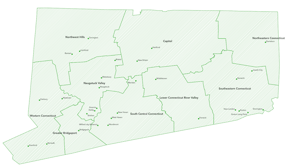
As of 12/1/2022 Geocodio now returns county-equivalent designations based on Connecticut's 9 Councils of Government for the "county" value in API responses and for processed spreadsheets.
Why was this change made?
Almost all functions of county government were abolished in Connecticut in 1960. Due to this, Connecticut has decided to officially migrate from using legacy County designations to county-equivalents based on Connecticut's 9 Councils of Government for statistical purposes.
You can read more about this change here: https://www2.census.gov/geo/pdfs/reference/ct_county_equiv_change.pdf
What are the county-equivalent regions?
- Capitol Planning Region
- Greater Bridgeport Planning Region
- Lower Connecticut River Valley Planning Region
- Naugatuck Valley Planning Region
- Northeastern Connecticut Planning Region
- Northwest Hills Planning Region
- South Central Connecticut Planning Region
- Southeastern Connecticut Planning Region
- Western Connecticut Planning Region

Copyright © 2014-2025 Dotsquare LLC, Norfolk, Virginia. All rights reserved.