Getting Started
What you can do with GeocodioSpreadsheet formattingAddress completionSpelling CorrectionFile formatsFile sizesIntersectionsPreviewing your spreadsheetReverse geocodingGoogle Maps API CompatibilityData Appends
Data Enrichment OverviewCensus Block/Tract/FIPS/GeoIDUSPS ZIP+4 (Full ZIP9)Congressional Districts & Contact InfoState Legislative DistrictsCensus: DemographicsCensus: Education & Veteran StatusCensus: FamiliesCensus: HousingCensus: IncomeFFIEC DataOCD IDsSchool DistrictsProvincial/Territorial RidingsFederal RidingsCanadian Census GeographiesTimezonesTroubleshooting
Country supportMap preview shows AfricaMissing coordinatesRow estimate too highSYLK ErrorTestingWhy are latitudes/longitudes slightly different when reverse geocoding?What happened to counties in Connecticut?What is a Census Block Group?Missing Leading Zeroes In SpreadsheetCongressional District 00 or 98Access Not Allowed ErrorBilling & Payment
Sales TaxesW-9Pay-As-You-Go CreditsEstimates/QuotesSet a usage limitWhat's a 'lookup'?When will I be charged?Add a Layer
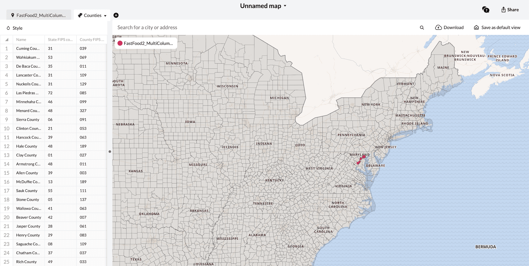
Once you've created a map and added a spreadsheet, you can also choose to add layers on top of that map that will outline established borders of specific regions or areas. This can make the map more dynamic and allow you to define geographic elements along with your markers.
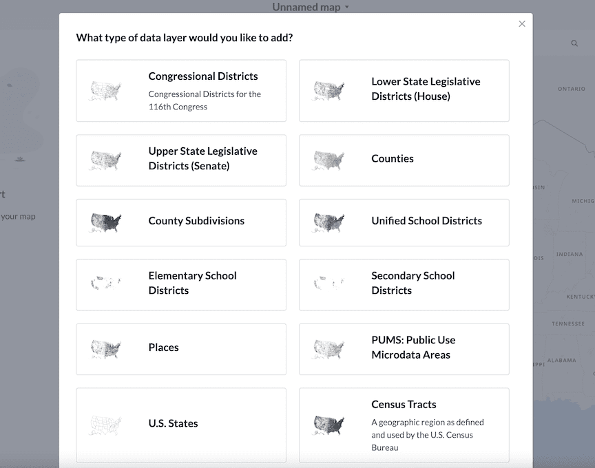
The following layers are available:
- US States
- Census Tracts
- Congressional Districts
- Lower State Legislative Districts (House)
- Upper State Legislative DIstricts (Senate)
- Counties
- County Subdivisions
- Unified School Districts
- Elementary School Districts
- Secondary School Districts
- Place (Typically Cities, Towns, Villages and Boroughs)
- PUMS: Public Use Microdata Areas
Added layers will appear on top of the base map. You can hover your cursor over top of an individual element to highlight it.
Multiple layers can be added on top of each other, but only the top layer will be interactive.
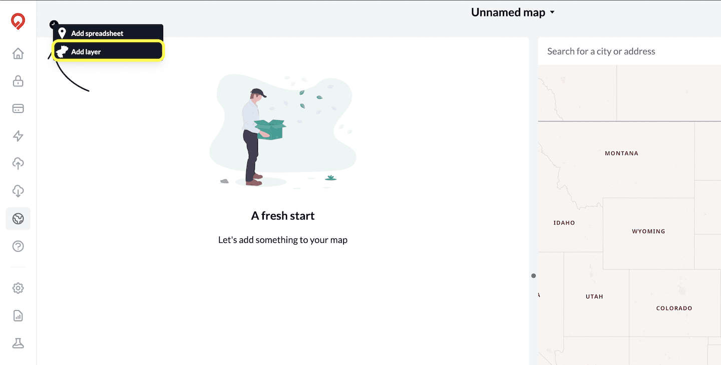
How to Add a Layer
In your map, go to the top left corner of the page and click on the plus button. A small menu will open. Choose the "Add Layer" option.
A large layers menu will open. You can select from all of the layer options listed above by clicking on the box of the one you require.
Your map will automatically re-render with the layer placed on top of the map.