
Guides
Census: Education & Veteran Status
Census: Education & Veteran Status
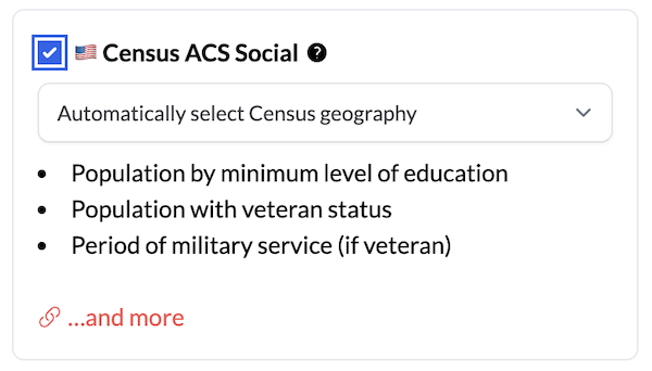
With Geocodio, you can match addresses or coordinates to the Census Bureau's American Community Survey on education levels, veteran status, and length of military service.
This data is available via API as well as spreadsheet upload. If you're uploading a spreadsheet, you can click the "Social" append in Step 3 of the upload process to append this data.
Geocodio returns Census education and veteran status data from the most recent five-year American Community Survey, which is currently the 2024 survey results published in 2026. (The 1-year American Community Surveys do not have granularity at this level.)
Selecting the geography level
With version 1.8 of the Geocodio API and the current version of the spreadsheet geocoding tool, Census veteran status and education data is automatically returned at the most appropriate geographic-level based on the accuracy of the geocoded result.
For example:
| Accuracy Type | Census Geography |
|---|---|
| rooftop, range_interpolation, nearest_street, point, nearest_rooftop_match, street_center, intersection | Census Block Group |
| nearest_place, place | Census Place |
| county | County |
| state | State |
With Geocodio, you can also explicitly request Census household and family data for a specific geographic level through our API or through the spreadsheet geocoding tool. Data is available at the following geographies:
Block Group
Tract
Place
County Subdivision
County
MSA
State
Via API, you should add the geography name to your ACS field request. For example:
acs-social-tract(for Census Tract level)acs-social-county(for County level)acs-social-place(for Census Place level)
When using Geocodio's spreadsheet geocoding tool, you can choose which geographic level you'd like to receive Census data for by using the dropdown menu that appears after selecting the ACS Social data append.
Please note: We do not provide data at the individual household level.
If you are using an API version prior to v1.8, all results are returned at the Census Block Group level.
Download an example
You can see download an example spreadsheet of the results with Census education and veteran data added to addresses here and to latitude/longitude coordinates here
Census Education/Veteran Data Returned
We provide the data exactly as it is packaged by the Census Bureau in the breakouts it gives. The only change we have made is to add a "percentage" calculation to aid ease of use.
The data returned includes the following data points. For each data point, the data returned includes the value, margin of error, and percentage.
Population by minimum level of education (Table #B15002)
No schooling, nursery to 4th grade, 5th and 6th grade, 7th and 8th grade, 9th grade, 10th grade, 11th grade, 12th grade - no diploma, high school graduate or equivalent, some college (1+ years, no degree), Associate's Degree, Bachelor's Degree, Master's Degree, professional school degree, Doctorate
Results broken out by all genders, female, and male
Veteran status for population over age 18 (Table #B21001)
Veteran, non-Veteran
Results broken out by all genders, female, and male
Period of military service for veterans (Table #B21002)
Wars
Gulf War (9/2001 or later), no Gulf War (8/1990 to 8/2001), no Vietnam War
Gulf War (9/2001 or later), Gulf War (8/1990 to 8/2001), no Vietnam War
Gulf War (8/1990 to 8/2001), no Vietnam War
Gulf War (8/1990 to 8/2001) and Vietnam War
Vietnam War, no Korean War, no World War II
Vietnam War and Korean War, no World War II
Vietnam War and Korean War and World War II
Korean War, no Vietnam War, no World War II
Korean War and World War II, no Vietnam War
World War II, no Korean War, no Vietnam War
Between Gulf War and Vietnam War only
Between Korean War and World War II only
Pre-World War II only
Special ACS Values
There are a number of special values that may be returned when working with ACS data. Use the chart below to determine their meaning, which can assist with troubleshooting.
| Value | Definition |
|---|---|
| -888888888 | Estimate not applicable or not available |
| -999999999 | Insufficient sample cases in the geographic area |
| -222222222 | Margin of error couldn't be computed due to insufficient sample |
| -555555555 | Controlled estimate (no sampling error) |
Cost
This data append is available for all plans.
Requests are billed as geocode + ACS Social info (i.e., two lookups). For example, if you have 100 addresses that you want Veteran and Education information for, that would count as 200 lookups.
Pay-as-you-go customers can calculate how much this will cost you and how long it will take here.
Guides
for everything Geocodio
Guides
for everything Geocodio
Census: Education & Veteran Status
With Geocodio, you can match addresses or coordinates to the Census Bureau's American Community Survey on education levels, veteran status, and length of military service.
This data is available via API as well as spreadsheet upload. If you're uploading a spreadsheet, you can click the "Social" append in Step 3 of the upload process to append this data.
Geocodio returns Census education and veteran status data from the most recent five-year American Community Survey, which is currently the 2024 survey results published in 2026. (The 1-year American Community Surveys do not have granularity at this level.)
Selecting the geography level
With version 1.8 of the Geocodio API and the current version of the spreadsheet geocoding tool, Census veteran status and education data is automatically returned at the most appropriate geographic-level based on the accuracy of the geocoded result.
For example:
| Accuracy Type | Census Geography |
|---|---|
| rooftop, range_interpolation, nearest_street, point, nearest_rooftop_match, street_center, intersection | Census Block Group |
| nearest_place, place | Census Place |
| county | County |
| state | State |
With Geocodio, you can also explicitly request Census household and family data for a specific geographic level through our API or through the spreadsheet geocoding tool. Data is available at the following geographies:
Block Group
Tract
Place
County Subdivision
County
MSA
State
Via API, you should add the geography name to your ACS field request. For example:
acs-social-tract(for Census Tract level)acs-social-county(for County level)acs-social-place(for Census Place level)
When using Geocodio's spreadsheet geocoding tool, you can choose which geographic level you'd like to receive Census data for by using the dropdown menu that appears after selecting the ACS Social data append.
Please note: We do not provide data at the individual household level.
If you are using an API version prior to v1.8, all results are returned at the Census Block Group level.
Download an example
You can see download an example spreadsheet of the results with Census education and veteran data added to addresses here and to latitude/longitude coordinates here
Census Education/Veteran Data Returned
We provide the data exactly as it is packaged by the Census Bureau in the breakouts it gives. The only change we have made is to add a "percentage" calculation to aid ease of use.
The data returned includes the following data points. For each data point, the data returned includes the value, margin of error, and percentage.
Population by minimum level of education (Table #B15002)
No schooling, nursery to 4th grade, 5th and 6th grade, 7th and 8th grade, 9th grade, 10th grade, 11th grade, 12th grade - no diploma, high school graduate or equivalent, some college (1+ years, no degree), Associate's Degree, Bachelor's Degree, Master's Degree, professional school degree, Doctorate
Results broken out by all genders, female, and male
Veteran status for population over age 18 (Table #B21001)
Veteran, non-Veteran
Results broken out by all genders, female, and male
Period of military service for veterans (Table #B21002)
Wars
Gulf War (9/2001 or later), no Gulf War (8/1990 to 8/2001), no Vietnam War
Gulf War (9/2001 or later), Gulf War (8/1990 to 8/2001), no Vietnam War
Gulf War (8/1990 to 8/2001), no Vietnam War
Gulf War (8/1990 to 8/2001) and Vietnam War
Vietnam War, no Korean War, no World War II
Vietnam War and Korean War, no World War II
Vietnam War and Korean War and World War II
Korean War, no Vietnam War, no World War II
Korean War and World War II, no Vietnam War
World War II, no Korean War, no Vietnam War
Between Gulf War and Vietnam War only
Between Korean War and World War II only
Pre-World War II only
Special ACS Values
There are a number of special values that may be returned when working with ACS data. Use the chart below to determine their meaning, which can assist with troubleshooting.
| Value | Definition |
|---|---|
| -888888888 | Estimate not applicable or not available |
| -999999999 | Insufficient sample cases in the geographic area |
| -222222222 | Margin of error couldn't be computed due to insufficient sample |
| -555555555 | Controlled estimate (no sampling error) |
Cost
This data append is available for all plans.
Requests are billed as geocode + ACS Social info (i.e., two lookups). For example, if you have 100 addresses that you want Veteran and Education information for, that would count as 200 lookups.
Pay-as-you-go customers can calculate how much this will cost you and how long it will take here.